
Fin4Crop
Fin4Crop is Finapp’s portal dedicated to agriculture, offering a range of features designed to support agricultural businesses in the proper management of irrigation thanks to the unique knowledge of soil moisture provided by Finapp.
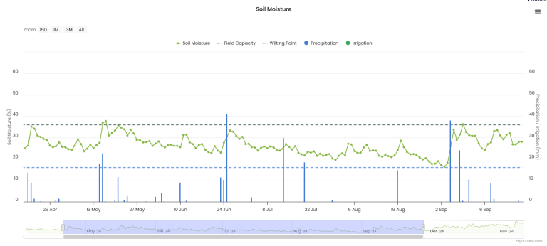
Fin4Crop – Soil moisture trend
Finapp provides data of soil moisture on a large scale (5 ha), in depth (about 50 cm) and in real time.
The information included are:
- Rainfall and irrigation data to show how soil moisture responds.
- Field capacity and wilting point values, providing the essential references for making irrigation decisions.
One Finapp probe can be representative of an area bigger than 5 hectares (more than 100 ha) if these 3 conditions are respected:
1. Monoculture
2. Similar irrigation management
3. Similar exposures in the case of non-flat terrain

Fin4Crop – Decision Supporting System
When and how much to irrigate
Fin4Crop’s platform provides to our clients integrated information about:
- Customized recommendations on what to do in the right time.
- Uses weather forecasts and AI to predict soil moisture levels up to a 7 days in advance.
- Insights into soil moisture and meteorological data.
- Precise scheduling of irrigation to avoid operating in emergency situation
Crops at the top? Try Fin4Crop
Fin4Crop – Soil moisture maps
By setting the light and compact Finapp probe in motion is possible to provide detailed and costumed map of soil moisture.
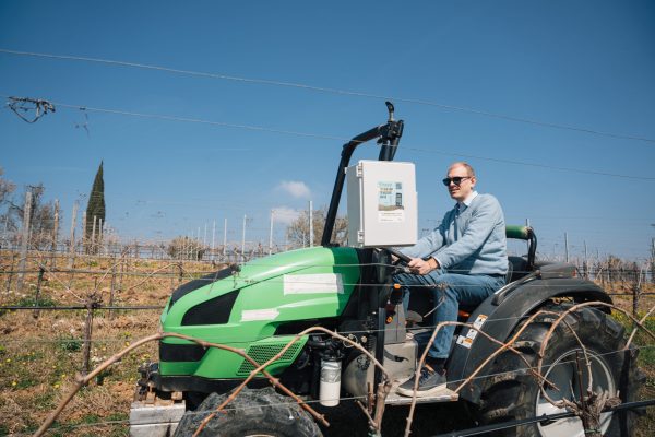
- Finapp probe can be installed or easily transported on agricultural machinery or on irrigation systems such as rainger/pivot.
- By integrating GPS data with soil moisture measurements,it is possible to generate a soil moisture map with spatial resolution down to 20 meters.
- Enable the use of variable-rate irrigation systems, which are becoming increasingly popular on the market, allowing for differentiated irrigation “meter by meter”
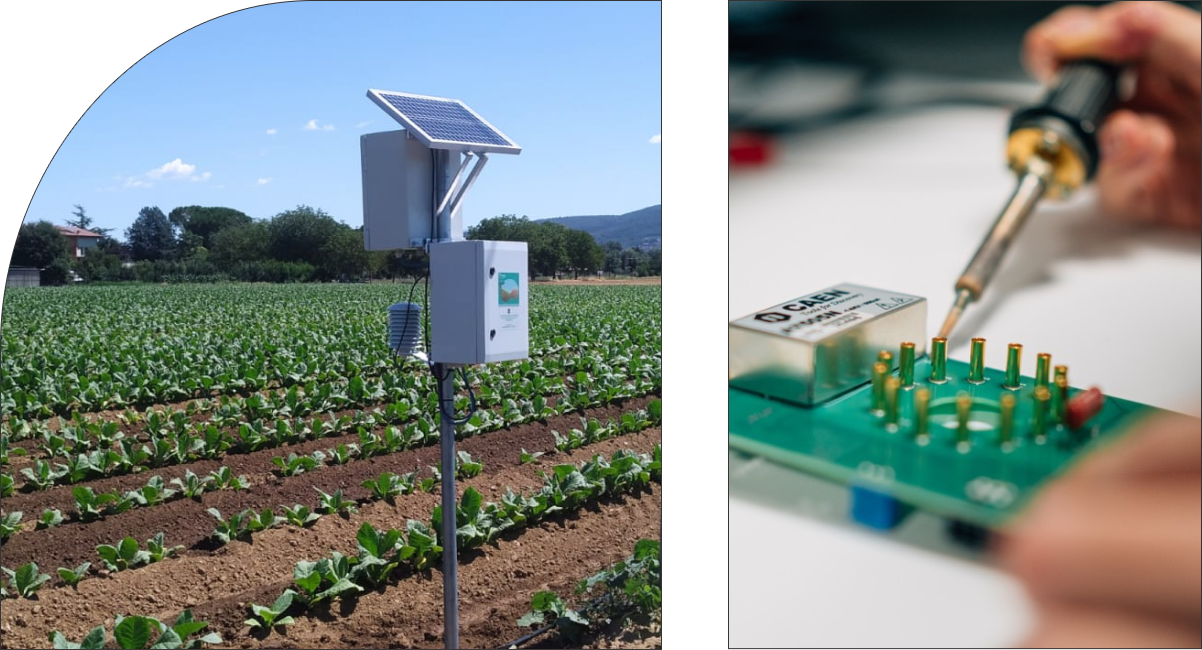
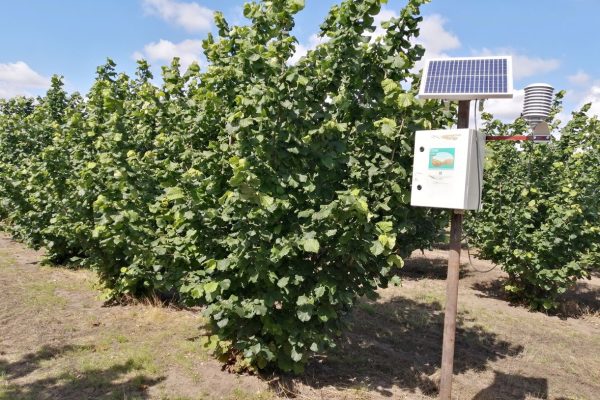
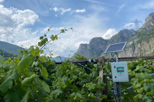
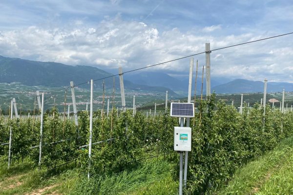
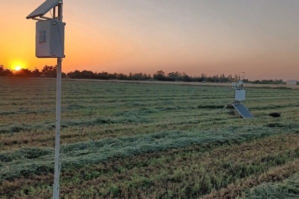
Pictures of Installations
FAQ common questions
Why is an "average" measurement of an agricultural area sufficient?
If we hypothetically knew the soil moisture every 10 cm by installing thousands of point probes, we would not be able to give different irrigation to every single plant, because even in the case of drip irrigation, the amount of water coming out of each individual nozzle is always the same. Two different irrigation sectors are needed to provide different amounts of water. Within an irrigation sector, the amount of irrigated water will always be the same. In some cases, an irrigation sector may cover an area of one hectare, in small plots, while in large plots the sectors are much larger. For this reason, having a soil moisture value for each irrigated sector is the maximum detail needed.
Can the sensor control irrigation?
No, we only provide a measure of soil moisture. Knowing the soil texture, we can also integrate field capacity and wilting point values. Ideally, soil moisture should always be within these two values to avoid water stress, below the wilting point, or excessive water uptake that can lead to the birth of diseases (ex: cercospora beet), above the field capacity.
Moving the Finapp sensor to different fields/crops, is it possible?
Yes, it is possible since the installation is very simple and the probe can operate anywhere, but it is not recommended. The probe is designed to stay at least one season in the same place to provide useful information for irrigation management, but also to have a data history for subsequent seasons.
Do different soil types affect the measurement of soil moisture?
No, the Finapp probe uses neutron counting to measure soil moisture, and neutrons are only affected by the presence of hydrogen. Some amount of hydrogen may be present in the soil, either within organic substance or dissolved minerals. However, this amount is constant over time (taking human activities as a reference) and for this reason does not disturb the soil moisture signal.
Can the instrument placed in the fixed station be used to obtain soil maps with a rover technology?
No, the probe used for soil moisture maps differs from the fixed one because it has GPS integration and a greater ability to count neutrons and muons.
What is the purpose of soil moisture mapping of farmland?
2D maps of the soil moisture of the crop.
Characterize areas with similar hydrologic behavior.
Irrigation system health and efficiency.
Use VRT irrigation systems.
Mapping soil moisture in an area of about 10 hectares (done in 2.30h).
How has the quality of the mapping done with the CRNS sensor been demonstrated?
Finapp collaborates with DISTAL, Department of Agrifood Science and Technology at the University of Bologna, which is in charge of validating the data obtained from our CRNS probes. Gravimetric sampling and measurements with portable TDR probes were carried out to have a sufficiently large number of point measurements of soil moisture. All these data were then averaged according to an appropriate scheme to return a soil moisture map with a resolution like that provided by Finapp. Data analysis shows that the values are similar, and the variability of soil moisture is seen correctly by the Finapp probes placed in motion in the field.
What soil moisture value does the sensor report to the user?
Finapp provides the gravimetric soil moisture figure (kg/kg). If the soil density value (Bulk density) is available, volumetric moisture (l/l) can also be obtained.
Risk of theft: is insurance provided? Is it equipped with a padlock? Does it have an alarm for door opening?
The Finapp probe can be insured like any other property. No alarm or padlock is provided, but the front door of the probe container is locked. The solar panel is attached to the holder with unscrewable security screws.
Is it the soil texture evaluation service available?
Yes, we can provide this service which will be quoted from time to time according to the Client’s needs.
Does Finapp provide an agronomist for texture assessments, soil analysis, technical advice?
Yes, this is a service that will be quoted time to time according to the Client’s needs.
How deep is it able to measure?
The Finapp probe provides a soil moisture data representative of the first 30-50cm or so. The depth is dictated by the energy of the neutrons, i.e., the ability to penetrate the soil, and not by the type of instrumentation used.
What range/size of territory can it cover?
The range of the probe depends on the ability of the neutrons to move through the air before decaying. The standard measurement at sea level is 5 hectares, or a radius of about 125m. As you go up in altitude, the area increases because the thinner air allows neutrons to travel longer. At 2’000m, the radius reaches about 250m. Another factor that varies the range is the height at which the probe is installed. Typically, the probe is installed 2m above the ground, but by lowering it, the radius decreases, to a minimum of about 20m if placed on the ground, while it increases for higher installations.
Does it work if there are rivers or forests nearby?
The presence of biomass does not affect the probe’s ability to measure soil moisture. In contrast, the presence of rivers or lakes does. An irrigation canal will not contain enough water to affect the measurement; therefore, these assessments must be made on a case-by-case basis.
Does the probe work in mobile mode i.e. installed on a vehicle?
Yes, an ad hoc probe is used, which integrates GPS with a greater capacity to count neutrons. In this case it is possible to have soil moisture maps, with a maximum resolution of about 10m.
Meeting customers’ needs
At Finapp we are committed to meeting the scientific measurement instrumentation needs of our customers, we enthusiastically help all those who work sustainably and fairly, we support those who advance science and technology for the benefit of humanity. Finapp believes in innovation as well as service.
Do not hesitate to get in touch with us for an appointment, visit, consultation, we will try to answer all your questions trying to suggest some possible innovative solutions.
Filter
Business Cases, Poster, Abstract, Literature
Here is how professionals and scholars use Finapp probes.
A good example of how to get the maximum benefit from our innovation.
