


Home » Applications »

Fin4Crop
Fin4Crop is the advanced portal dedicated to precision farming, acting as a comprehensive decision support system (DSS) in agriculture. It translates the unique, deep-layer soil moisture data provided by the Finapp Probe into actionable insights. Designed for modern agricultural businesses, it optimizes irrigation and drought management, ensuring sustainability and operational efficiency.
Agricultural water management: precision irrigation systems
Efficient agricultural water-management is the key to maximizing crop yield while preserving resources. Fin4Crop bridges the gap between raw data and daily farming operations, providing a level of detail that transforms how you manage your fields. This precision is vital not just for the farm, but for broader water resource management and environmental monitoring, ensuring that agricultural practices remain sustainable within the wider ecosystem.
The system provides large-scale soil monitoring (covering ~5 hectares) and deep analysis (up to 50 cm), offering a representative view of the field that single-point sensors cannot match. The platform integrates critical hydrological parameters:
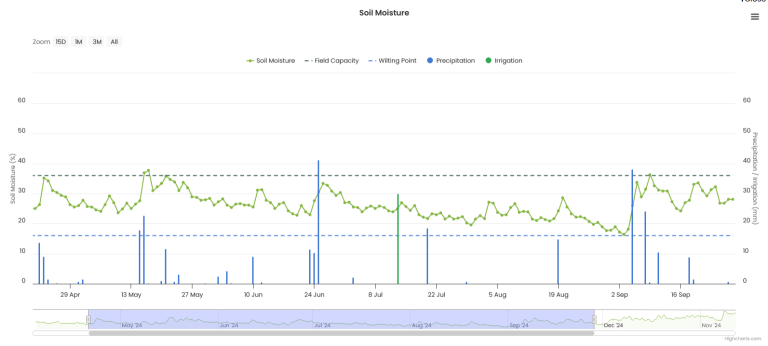
- Rainfall & Irrigation Tracking: visualize exactly how soil moisture responds to water input in real-time.
- Field Capacity & Wilting Point: these essential references define the “comfort zone” for your crops, preventing both water stress (dryness) and root asphyxia (saturation).
- Representative Data: a single probe covers over 5 hectares, provided the area shares similar monoculture, irrigation management, and sun exposure.

Predictive Analytics & AI: Smart Irrigation Scheduling
When and how much to irrigate
Fin4Crop is more than a dashboard; it is a proactive smart farming app designed to answer the critical question: When and how much to irrigate?
By leveraging artificial intelligence and weather forecasts, the platform empowers climate-smart agricultural practices:
- 7-Day Predictive Models: forecasts soil moisture levels up to a week in advance using integrated meteorological data.
- Customized Recommendations: delivers specific advice on irrigation timing to maintain optimal water content in crops.
- Risk Avoidance: enables precise scheduling to avoid emergency situations, reducing water waste and energy costs.
Crops at the top? Try Fin4Crop

Precision agriculture: mapping and VRT
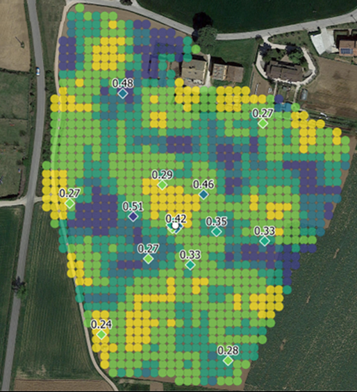
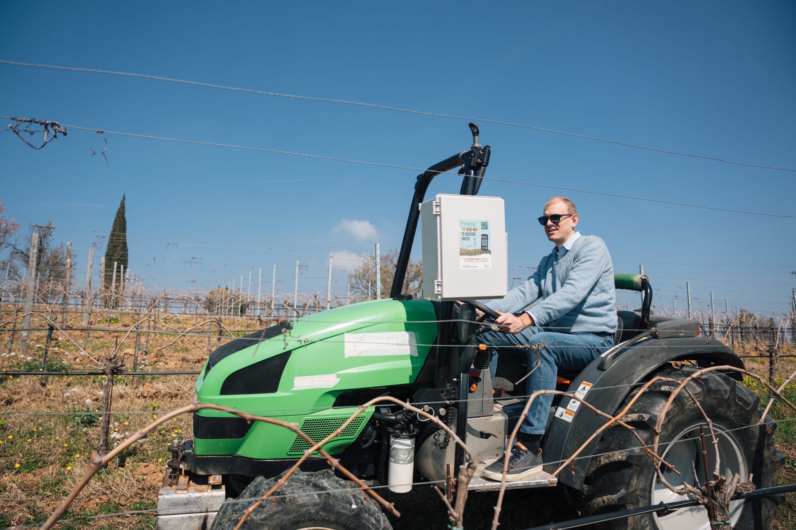
For farmers utilizing variable-rate irrigation systems (VRT), Fin4Crop offers advanced mapping capabilities. By mounting a mobile Finapp probe (Rover) on agricultural machinery or irrigation systems (like raingers/pivots), you can generate high-resolution maps.
- Spatial Resolution: Obtain detailed maps with a resolution down to 20 meters.
- Meter-by-Meter Efficiency: Enable differentiated irrigation, applying water only where strictly necessary based on the soil moisture map.
- System Health: Use maps to identify malfunctions in irrigation systems or areas with distinct hydrologic behavior. The capability to spot anomalies is so precise that the same Rover technology is used globally for urban water leak detection.
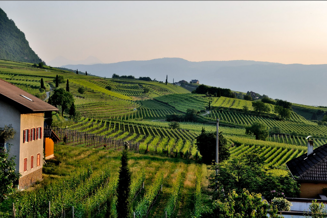
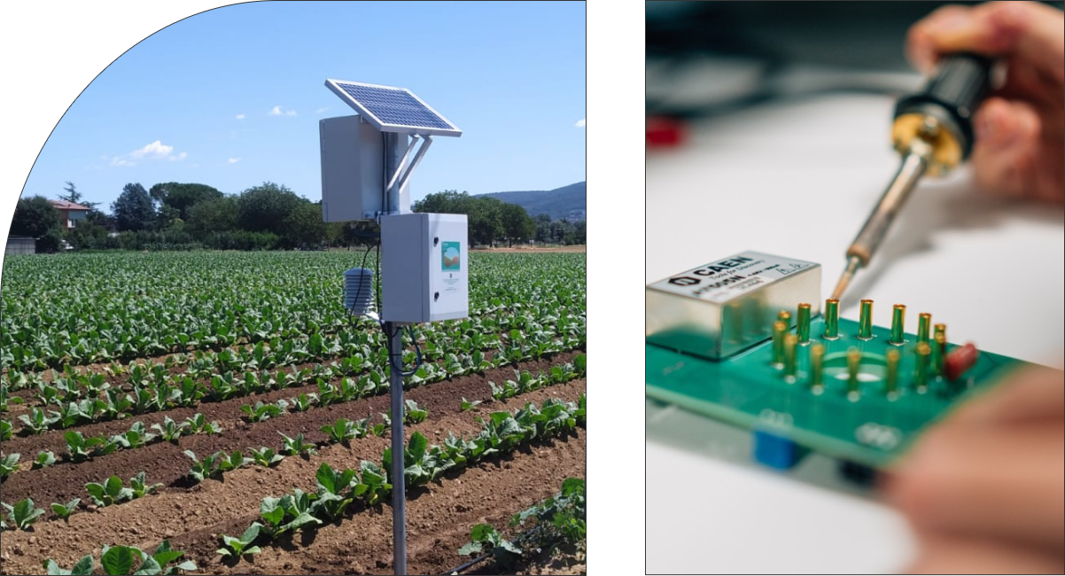
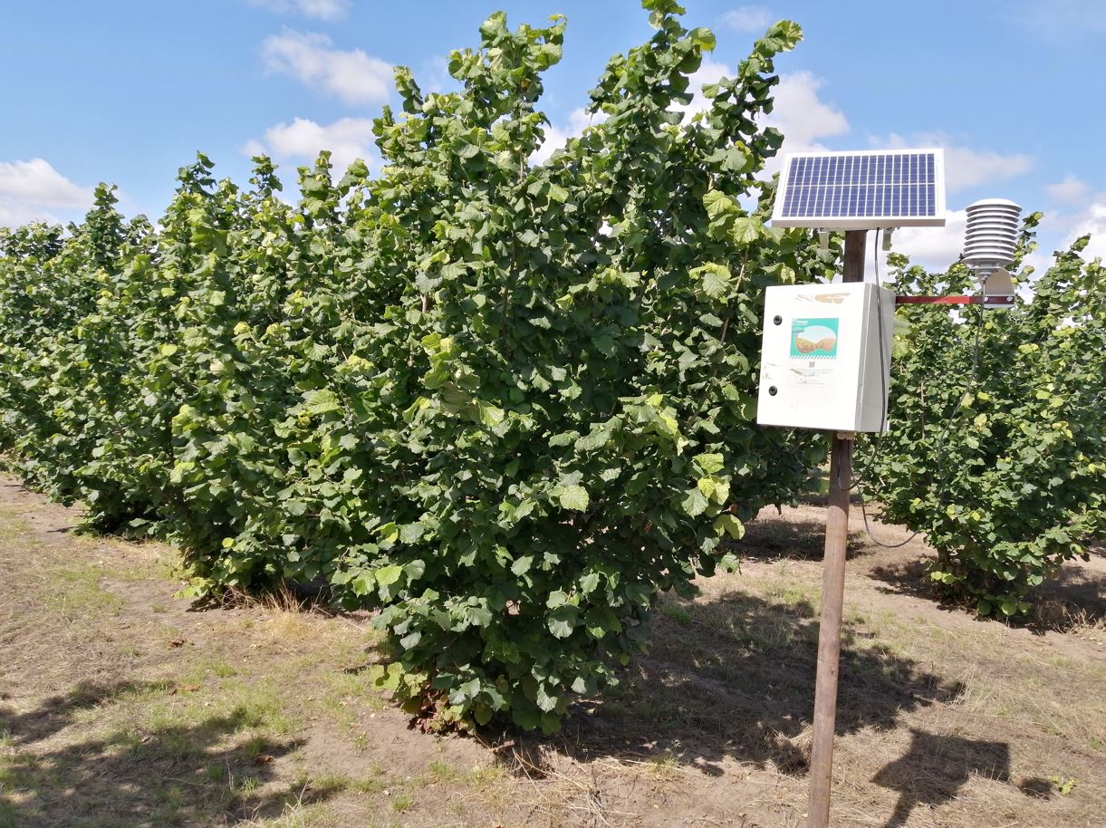
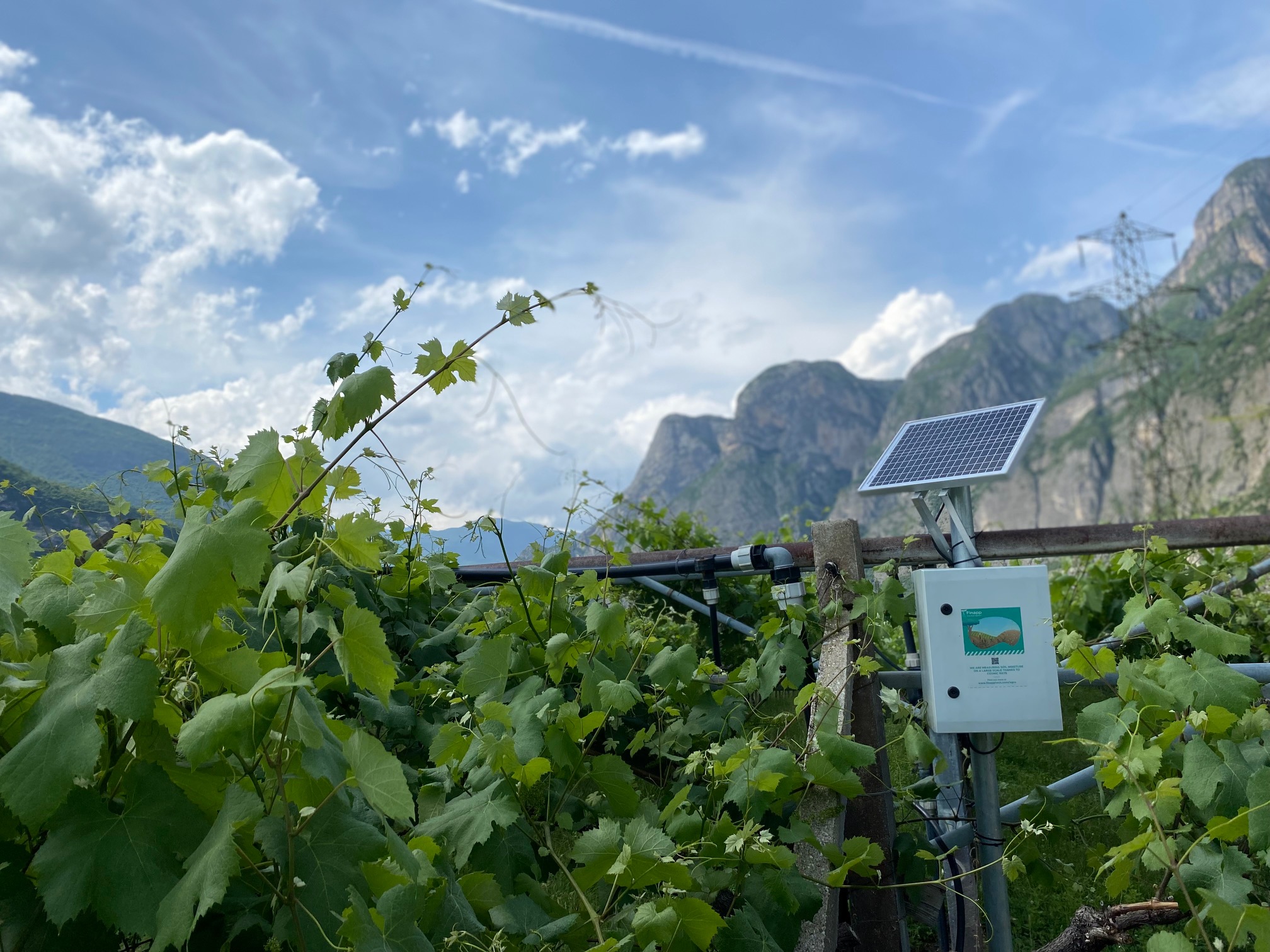
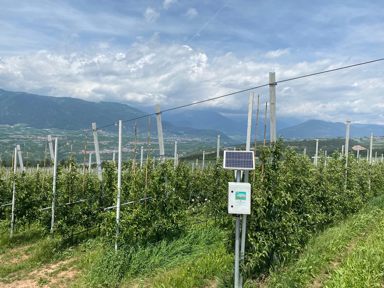
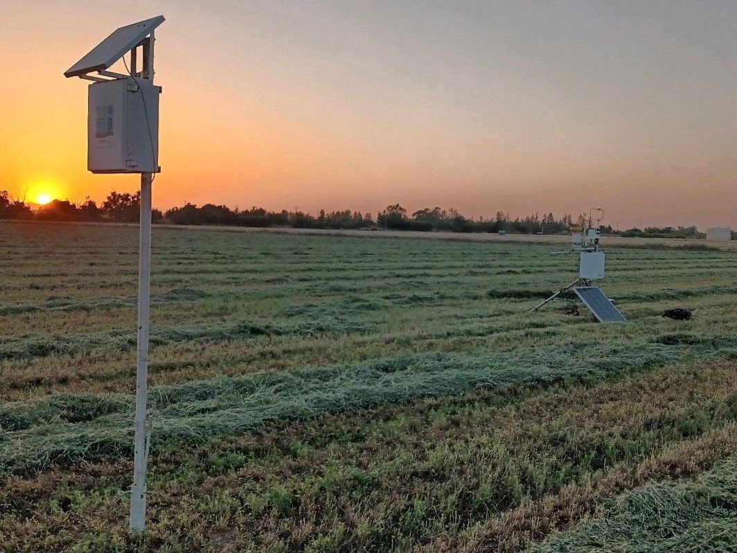
Field deployments: versatile installation examples
The Finapp system is engineered for seamless integration into any agricultural setting. Our gallery demonstrates the probe’s adaptability across different crops and mounting configurations, proving its non-invasive nature and robustness in real-world conditions.


FAQ Common questions
1. Measurement capabilities
What range/size of territory can it cover?
The range depends on neutron physics. At sea level, the standard measurement covers about 5 hectares (radius ~125m). As altitude increases, the air thins, allowing neutrons to travel further (e.g., at 2,000m, the radius reaches ~250m). The installation height also matters: typically installed 2m above ground for maximum range, lowering it reduces the footprint.
How deep does it measure?
The probe measures the root zone, typically the first 30-50 cm of soil. This depth is dictated by the energy of cosmic ray neutrons and their interaction with hydrogen, providing a much more relevant dataset for agriculture compared to surface-only sensors.
Why is an "average" measurement of 5 hectares better than point probes?
Managing irrigation based on thousands of single points is operationally impossible. Since irrigation sectors typically cover large areas (hectares), having a highly accurate, representative average value for the entire sector eliminates the “noise” of local variations. This provides the maximum useful detail for effective agricultural water-management.
2. Reliability & environmental factors
Do different soil types affect the measurement?
No. The CRNS technology counts neutrons, which are moderated almost exclusively by hydrogen (water). While soil minerals or organic matter may contain small amounts of hydrogen, this background level is constant. The variation in the signal is driven purely by changes in soil moisture, making the probe independent of soil texture or salinity.
Does biomass (crops/forests) affect the measurement?
Generally, the water content within crop biomass (e.g., a growing corn field) is negligible compared to the water in the soil volume and does not disturb the measurement. However, significant bodies of standing water, like nearby lakes or large rivers, can influence the signal and must be accounted for during installation.
3. Operational usage (DSS & Handling)
Can the sensor directly control the irrigation system?
Fin4Crop is a Decision Support System (DSS). It provides the essential data—integrating Soil Moisture, Field Capacity, and Wilting Point—to inform your decisions. Ideally, moisture levels should remain between the Wilting Point (to avoid stress) and Field Capacity (to avoid saturation and disease onset like Cercospora). While we provide the trigger data, the physical actuation depends on your specific irrigation controller integration.
Is it possible to move the Finapp sensor to different fields?
Technically yes, as installation is simple and the probe operates anywhere. However, it is not recommended for the fixed station. The probe is designed to monitor a specific site over at least one season to provide consistent trends for irrigation management and to build a historical dataset for future predictive analysis.
4. Advanced features: soil moisture mapping
What is the purpose of soil moisture mapping?
Mapping allows you to visualize spatial variability within a field. Key benefits include:
- Generating 2D Soil Moisture Maps (approx. 10 hectares in 2.5 hours).
- Characterizing areas with similar hydrologic behavior.
- Checking irrigation system health (identifying clogged nozzles or leaks).
- Enabling VRT (Variable Rate) irrigation systems.
Does the probe work in mobile mode (on a vehicle)?
Yes. For mapping, we use a specific Mobile CRNS probe (Rover) which integrates high-precision GPS and has a higher sensitivity to count neutrons and muons while moving. This allows for the generation of soil moisture maps with a spatial resolution of about 10-20 meters.
Can the instrument placed in the fixed station be used for mapping?
No. The probe used for soil moisture mapping (Rover) differs from the fixed station model. The Rover is specifically engineered with enhanced counting capacity and integrated GPS to handle the dynamic nature of mobile measurement.
Call Us
Call Us
Call Us
Call Us
Call Us
Call Us
Call Us
Call Us
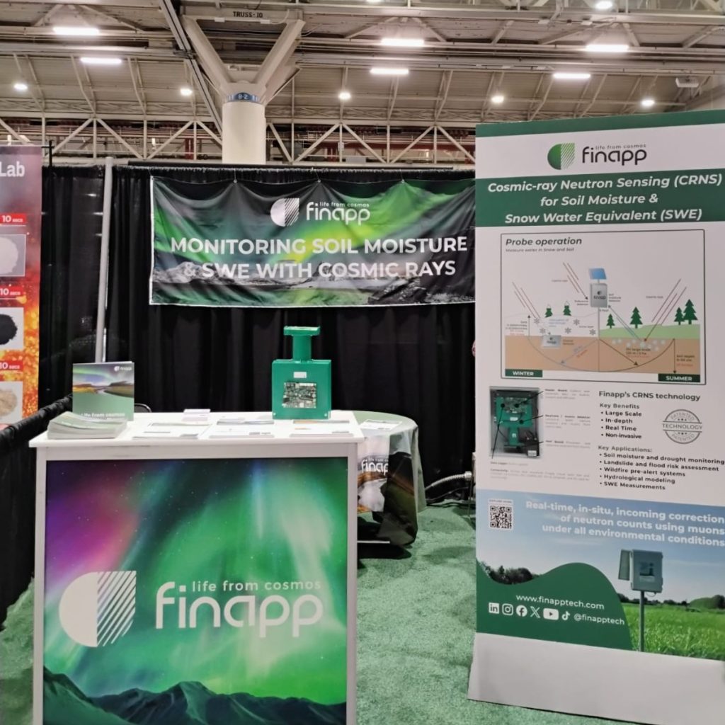
Innovation & support: your Partner in precision farming
At Finapp, we support those who advance science and technology for the benefit of humanity. Our solutions are rooted in rigorous scientific research, contributing to SDG 2 (Zero Hunger) through regenerative agriculture and soil health monitoring.
Ready to upgrade your irrigation strategy? Contact us for a demo of the Fin4Crop platform.
scroll down to explore
scroll down to explore
scroll down to explore
scroll down to explore
scroll down to explore
scroll down to explore
scroll down to explore
scroll down to explore
Filter


scroll down to explore
scroll down to explore
scroll down to explore
scroll down to explore
scroll down to explore
scroll down to explore
scroll down to explore
scroll down to explore
Business Cases, Poster, Abstract, Literature
Here is how professionals and scholars use Finapp probes.
A good example of how to get the maximum benefit from our innovation.

